SutherlandShireAustralia.com.au Sutherland Shire, Sydney Australia


Bushwalks
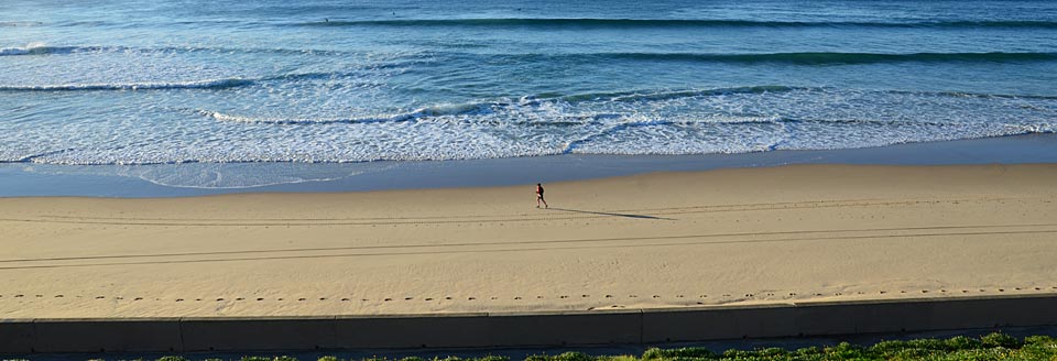
Royal National Park Walking Track Information
Royal National Park provides access to over 150 km of walking tracks for you to explore. For safety in these areas it is strongly recommended that you obtain the correct topographic map before setting out. Copies are available from the Audley visitor centre. Twelve of the better known tracks are marked on the map with accompanying track information provided here.

Coast Track
26 km, 2 days, difficulty: medium – hard.
This is a comfortable two day walk from Bundeena south to Otford. Variable terrain is covered including flat areas, beaches and escarpments. Magnificent views may be seen along the track. Bush camping is limited to North Era and permits are required. Emergency telephones are located at Wattamolla and Garie. Cabin communities are located at Burning Palms, Little Garie and South Era.
Bundeena Drive to Marley (via Deer Pool)
6.5 km, 3 hours return, difficulty: medium.
From the Marley car park, cross the road and follow the Marley Track through heathland to Deer Pool. From here the track ascends out of the small valley to meet the Little Marley Trail which provides ready access to the Marley Beach area.
Curra Moors Loop
10 km round trip, 5 hours, difficulty: medium.
The loop starts with the Curra Moors Track which passes through woodland forest into coastal shrub and heath and is an excellent springtime walk when the heath flowers are out. The grassland here can become a swamp after rain. From the waterfalls at Curracurrong, the view extends south to Wollongong. From the junction with the Coast Track, the walk heads south towards Garie North Head before linking back to the Curra Moors Trail and retracing your steps back to the car park.
Palm Jungle Loop
10 km round trip, 5 hours, difficulty: hard.
This loop starts down the steep Burgh Ridge looking north over the Era beaches and south to Burning Palms. A track veers to South Era Beach but take the right hand track to Burning Palms Beach. Further down the coast the Figure 8 Pool can be seen at low tide by taking a side trip along the rock platform south from Burning Palms Beach. South of Burning Palms the track enters Palm Jungle then climbs gradually to Werrong Lookout, a rocky outcrop with panoramic views of the South Coast. Follow the track to the fire trail junction. Turn right and follow Garawarra Ridge Trail north to Garawarra Farm through closed woodland or left to Otford Lookout and railway station.
Werrong Track
2 km return, difficulty: hard.
If you would like to visit a natural, secluded beach area take the track to Werrong. This starts at Otford Lookout and passes a sandstone cliff before dropping into littoral rainforest. This is a short but very steep walk. Werrong Beach is the only authorised nude bathing beach in Royal National Park.
Forest Path Track
4.5 km, 1.5 hours, difficulty: easy – medium.
A loop track that starts immediately south of Bola Creek, 0.75 km from the southern end of Lady Carrington Drive. The path traverses the lower slopes of Forest Island, a hill which has been isolated by the valleys of the Hacking River and Bola Creek which almost surround it. For access by car, park at the southern end of Lady Carrington Drive and follow the signs to the start of the path. By public transport catch the train to Waterfall Station and follow the Uloola Trail for approximately 1 km to the start of the Couranga Track. Follow the entire length of the Couranga Track (5 km) to where it terminates at the Forest Path Track.
Uloola Trail/Track
11 km, difficulty: medium.
The Uloola Trail leads from the high country around Waterfall Station, through heathland and woodlands to Uloola Falls. The falls and Blue Pools just upstream are popular lunch spots – especially in hot weather. Between Uloola Falls and Audley the Uloola Track passes Peach Trees Trig Station, watch for the short side track, which offers views out over the Hacking River Valley. Along the track the rock outcrops of Uloola Turrets are worth exploring while the Whaleback rock feature has been named due to the fanciful resemblance to whales surfacing for air.
Couranga Track
5 km, difficulty: medium.
The Couranga Track branches east approximately 1 km along the Uloola Trail and meanders downhill to Fosters Flat on the Hacking River. The track follows the route of an old logging track. At Fosters Flat you can still see the remains of the old sawpits where loggers cut and sawed valuable bluegum, blackbutt, turpentine and rainforest timber.
Lady Carrington Drive
9.6 km each way, difficulty: easy – medium.
Unsealed historic trail closed to vehicular traffic. Popular bicycle path and walking track. The route is crossed by 15 creeks, each of which is identified by its Aboriginal name.
Karloo Track
5 km, difficulty: medium – hard.
The Karloo Track leads from Heathcote Station to Uloola Falls via the beautiful Karloo Pool, a popular swimming and picnic site. The rock outcrops of Uloola Turrets, to the north east of Uloola Falls are also worth exploring.

Engadine Track
5 km, difficulty: medium.
This track provides access to Audley from Engadine Station.
Bungoona Path
1 km return, 30 mins, difficulty: easy.
The path winds its way across a typical ridgetop landscape to Bungoona Lookout. The path has been specially designed for wheelchair access. The lookout gives panoramic views of the Hacking River and Royal National Park.
Heathcote National Park Walking Track Information
Heathcote to Waterfall
10.8 km, 5 hours, difficulty: hard.
From the end of Freeman Road, Heathcote follow the Friendly Track through Scout leased lands to the junction of the Pipeline Trail. Head south along the trail which passes Mirang Pool to Battery Causeway. From here Lake Eckersley is worth exploring via a short side track approximately 250 m on the right further along the trail. Immediately after crossing the Battery Causeway the Bullawarring Track begins on the left which winds its way along the side of the valley, past the Goanna Track intersection to the Mooray Track junction and Kingfisher Pool. The Bullawarring Track continues adjacent to Heathcote Creek then up to the northern end of Warabin Street. Waterfall Station is a short walk from here. Bush camping is limited to Mirang Pool, Lake Eckersley and Kingfisher Pool and permits are required.
Pipeline Trail
9.3 km, 5 hours, difficulty: medium-hard.
The asphalt and gravel trail runs the length of Heathcote National Park from Heathcote Road to Woronora Dam Road and is a popular mountain bike trail and walking track. Picnic areas are located along the trail at Mirang Pool, Battery Causeway and Girronba.
Mooray Track
5 km round trip, 2.5 hours, difficulty: medium.
From the northern end of Warabin Street, Waterfall follow the Warabin Street Trail which runs into the 108 Trail. Continue down the 108 Trail for approximately 50 m. The Mooray Track begins here on the right and ends at Heathcote Creek. Return by retracing the route or take the Bullawarring Track to loop back to Waterfall via Kingfisher and Bondel Pools.
Waterfall to Lake Toolooma
1.2 km, 1 hour, difficulty: medium.
From the northern end of Warabin Street, Waterfall follow the Warabin Street Trail for approximately 100 m to the Bullawarring Track. Follow this track until the Lake Toolooma Trail junction. The trail heads south with the valley down to the right. A faint track will take you down to Lake Toolooma which is a picturesque and well-hidden dam best enjoyed near the dam wall and lily pads. Return to Waterfall by retracing your route.

 Michael Kuzilny - MK LAW SYDNEY

Tourist Information Phone (02) 9710 0888

Advertise on this website
- Less than $4/week
- Over 110,000 visitors each year
- Over 12,000 Facebook fans
- Be part of our growing community

Stralia Web's Regional Network
Albury Wodonga | Blacktown | Blue Mountains | Central Coast | Manly | Oberon | The Hawkesbury | Penrith | Sutherland Shire | Sydney Hills | Sydney Australia | Wagga Wagga
Sutherland Shire Australia Social Pages